| |
Maps of
PAKISTAN By Other Websites:
Worldwide Maps Links
The following maps were produced by the
U.S.
Central Intelligence Agency, unless otherwise indicated.
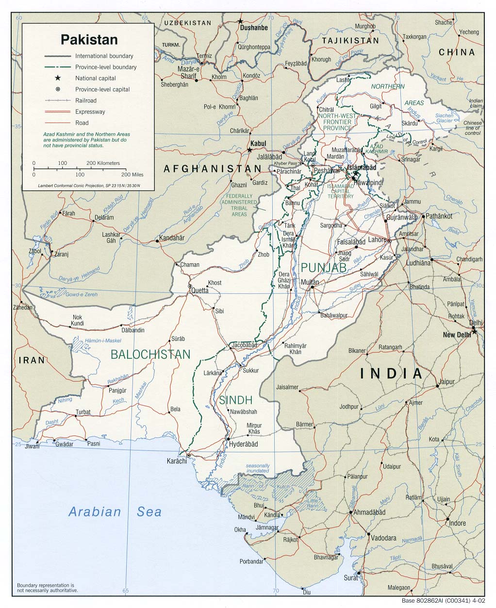
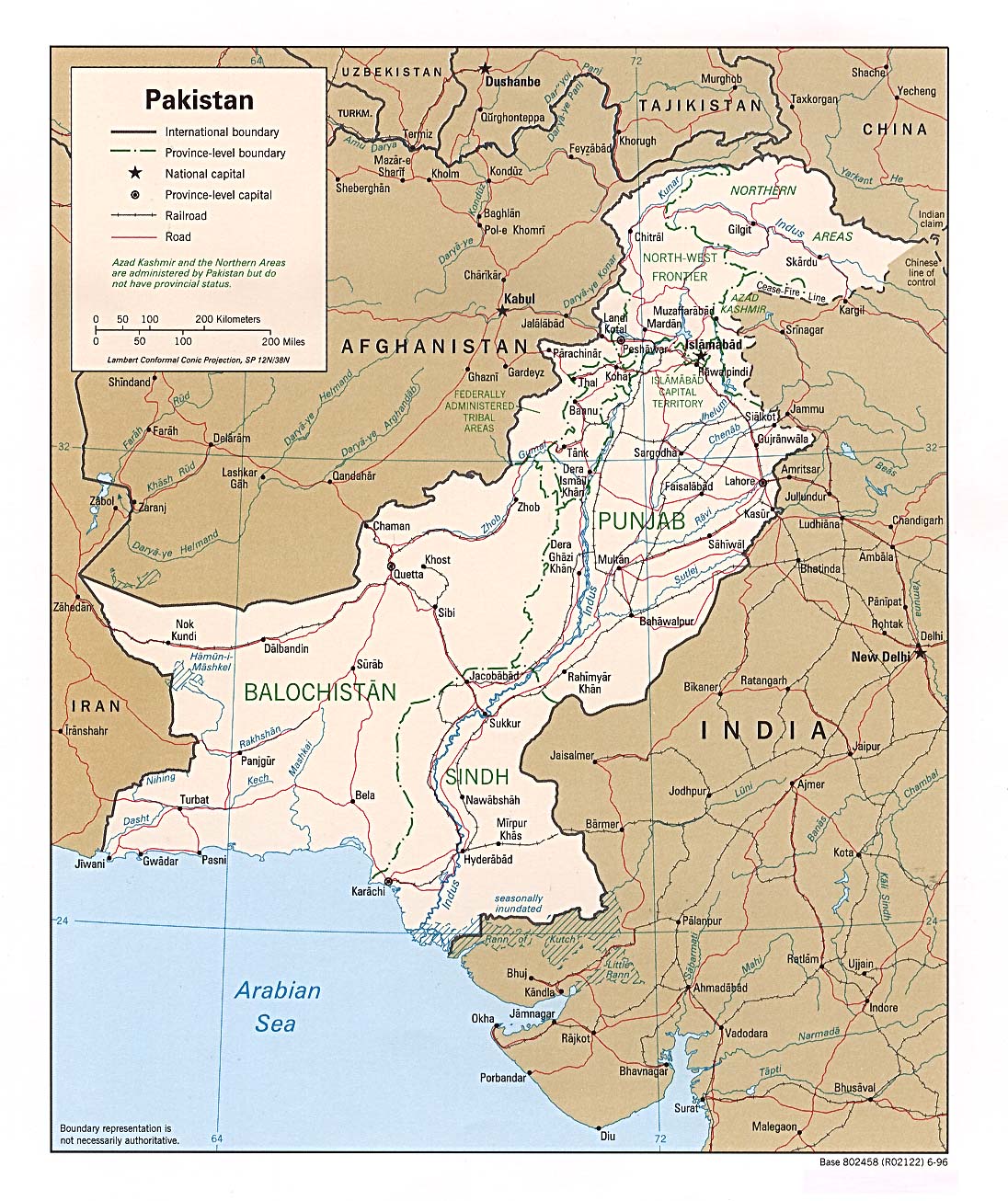
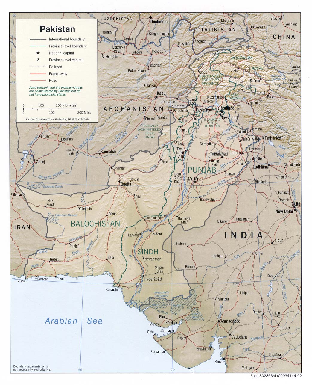
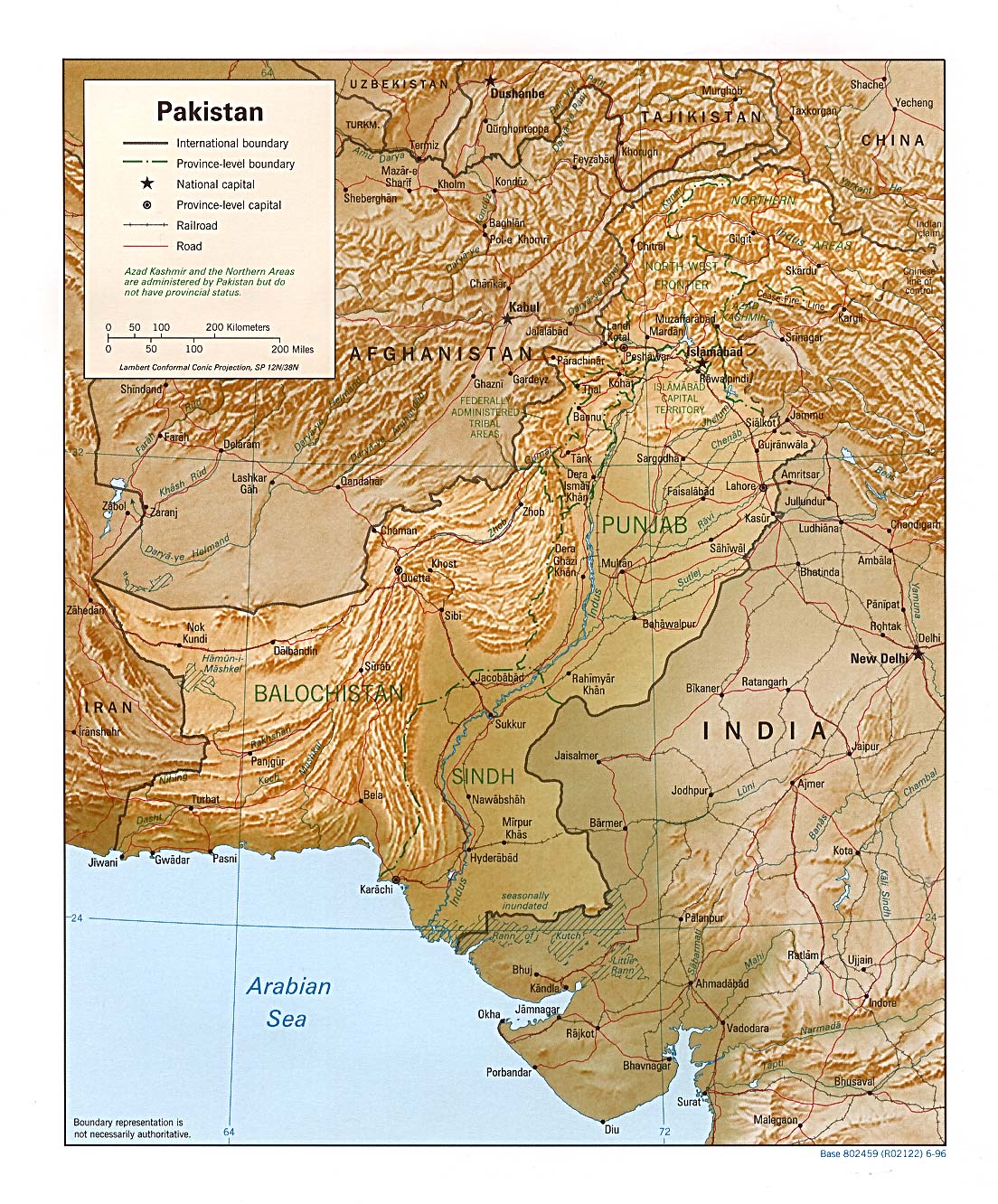
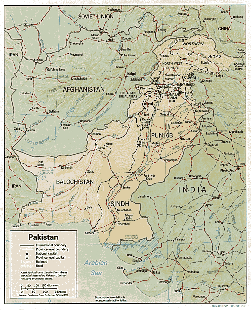
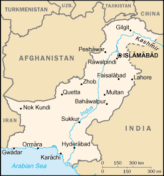
Pakistan Maps
Detailed Maps
-
Kashmir Maps
-
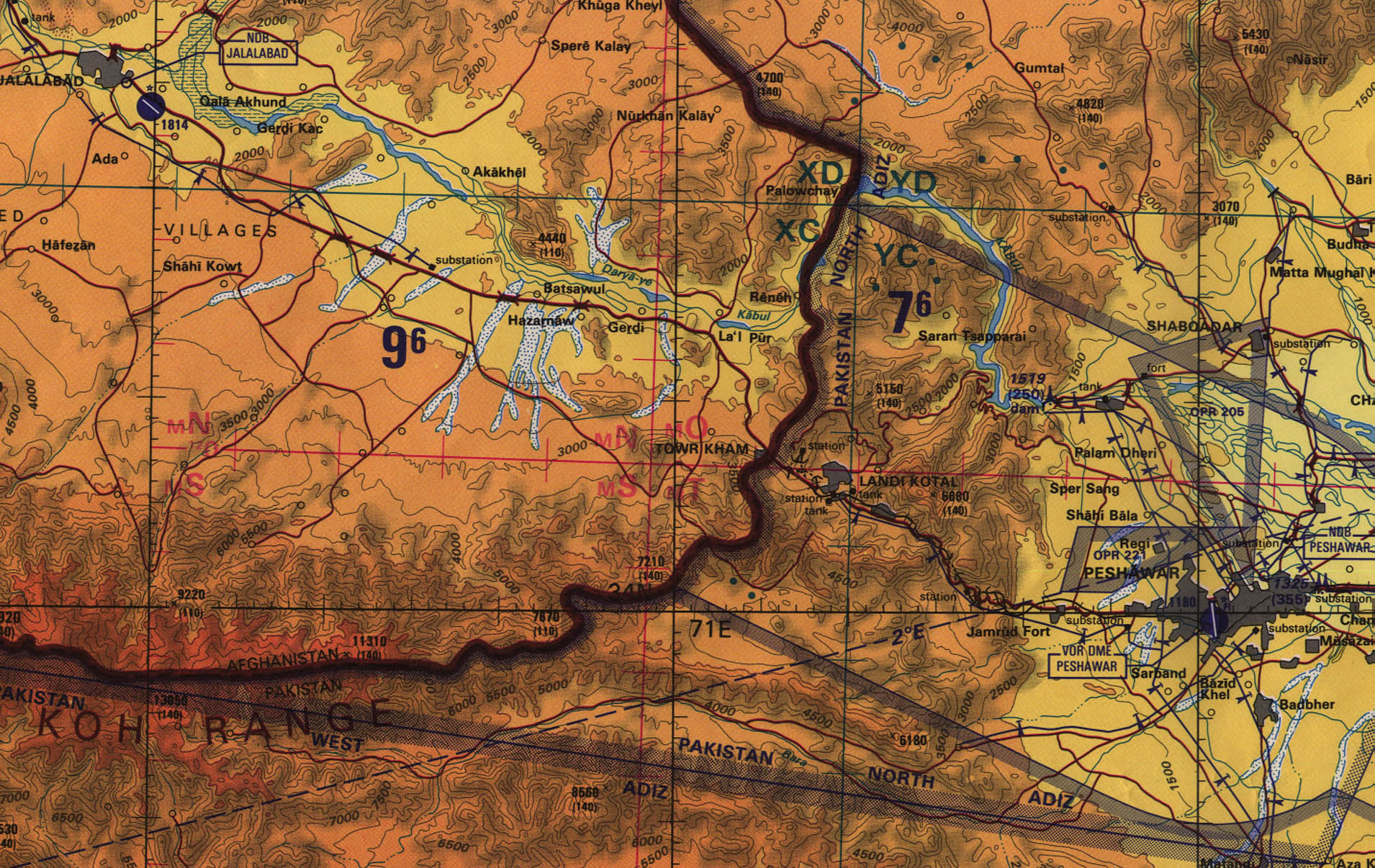
Jalalabad, Afghanistan - Peshawar, Pakistan Region
original scale 1:500,000 Portion of Tactical Pilotage Chart
TPC G-6C, U.S. Defense Mapping Agency, 1992 (774K) Not
for navigational use
-
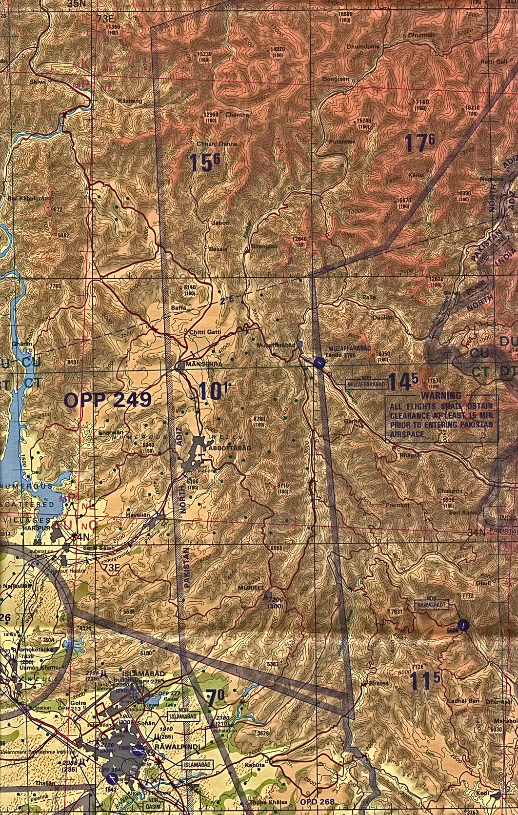
Muzaffarabad Border Region Original scale 1:500,000
Portion of Tactical Pilotage Chart TPC G-6C, U.S. Defense
Mapping Agency, 1992 (1.2MB) Not for navigational use
-
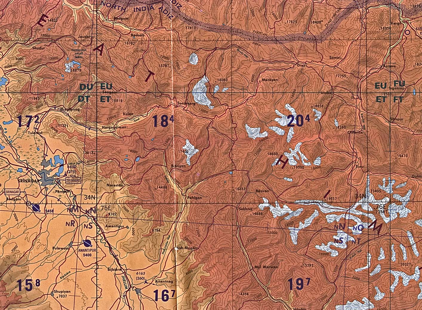
Srinagar Border Region Original scale 1:500,000 Portion
of Tactical Pilotage Chart TPC G-7D, U.S. Defense Mapping
Agency, 1995 (1.1MB) Not for navigational use
City Maps
-
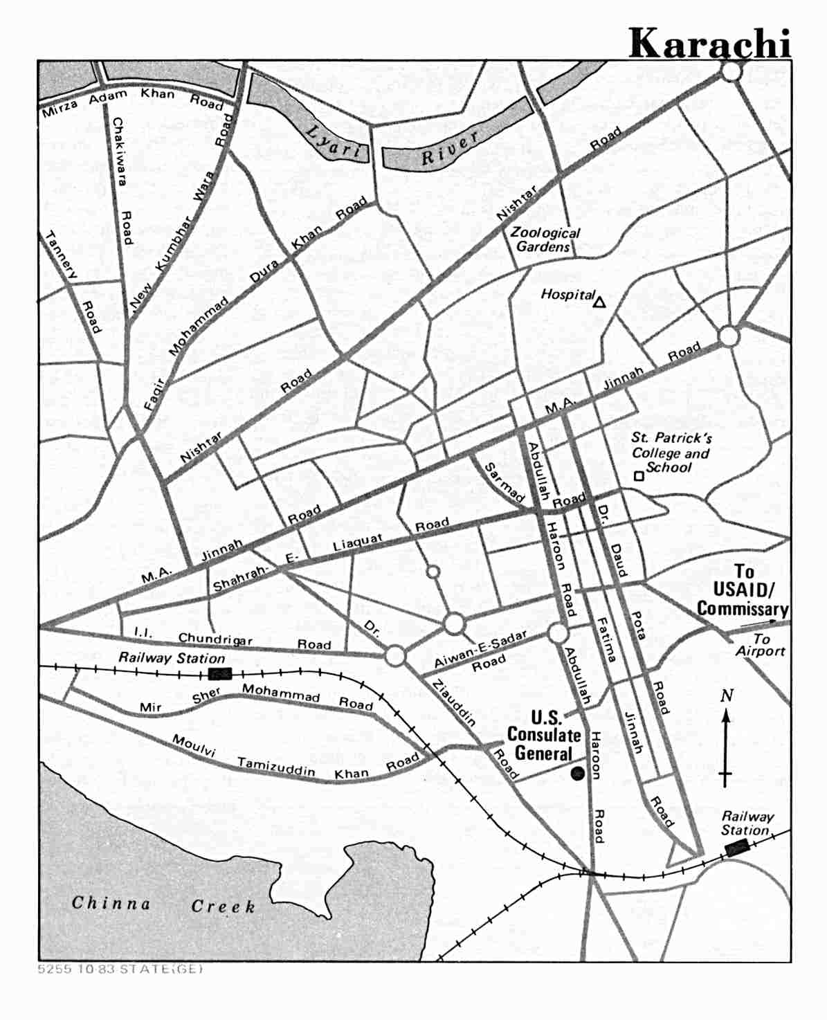
Karachi U.S. Department of State 1983 (91K)
-
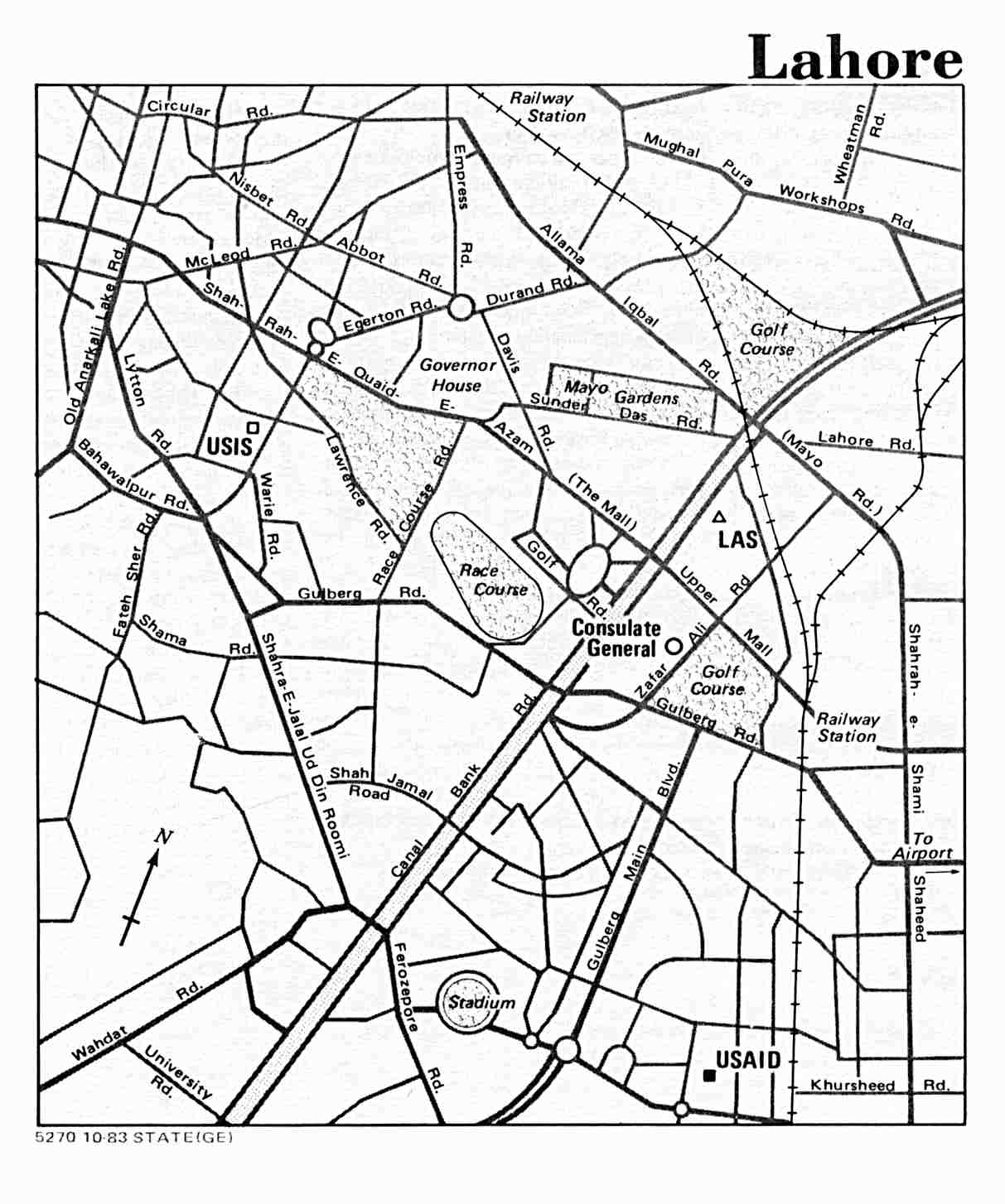
Lahore U.S. Department of State 1983 (115K)
-
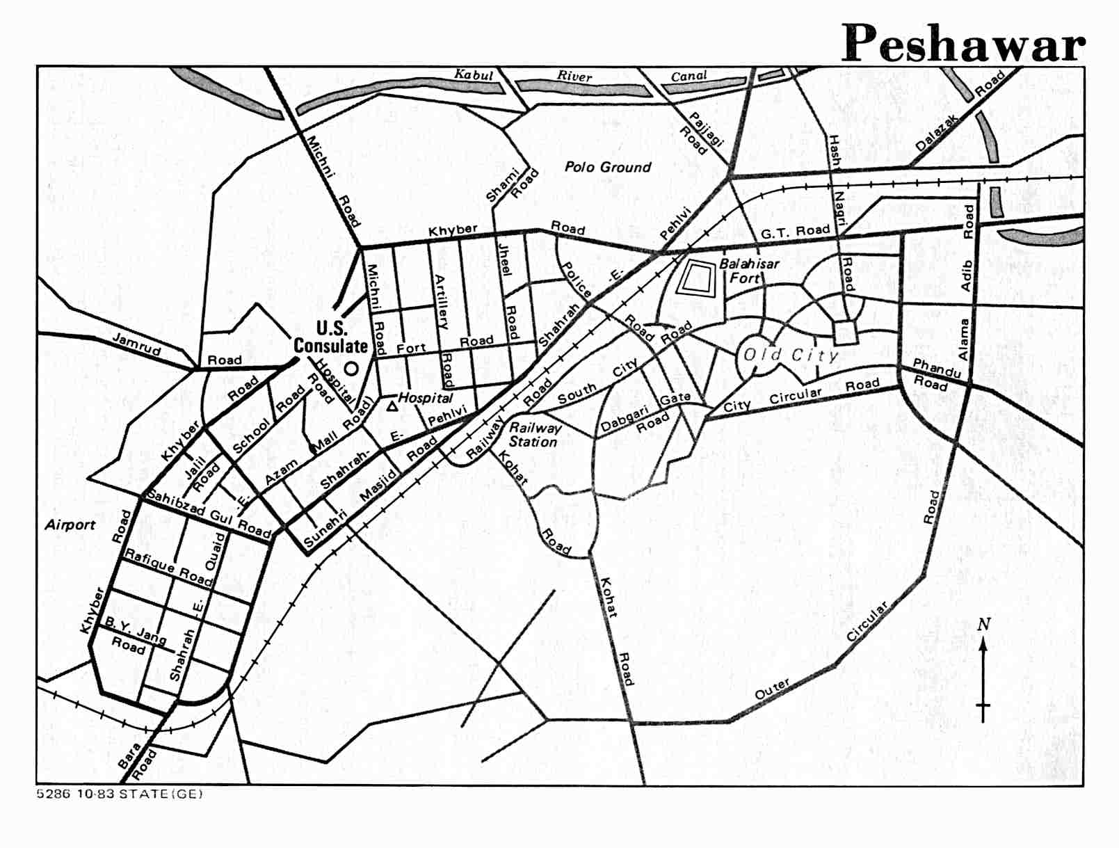
Peshawar U.S. Department of State 1983 (104K)
Thematic Maps
-
Pakistan (Major Ethnic Groups) 1980 (170K)
Historical Maps
-
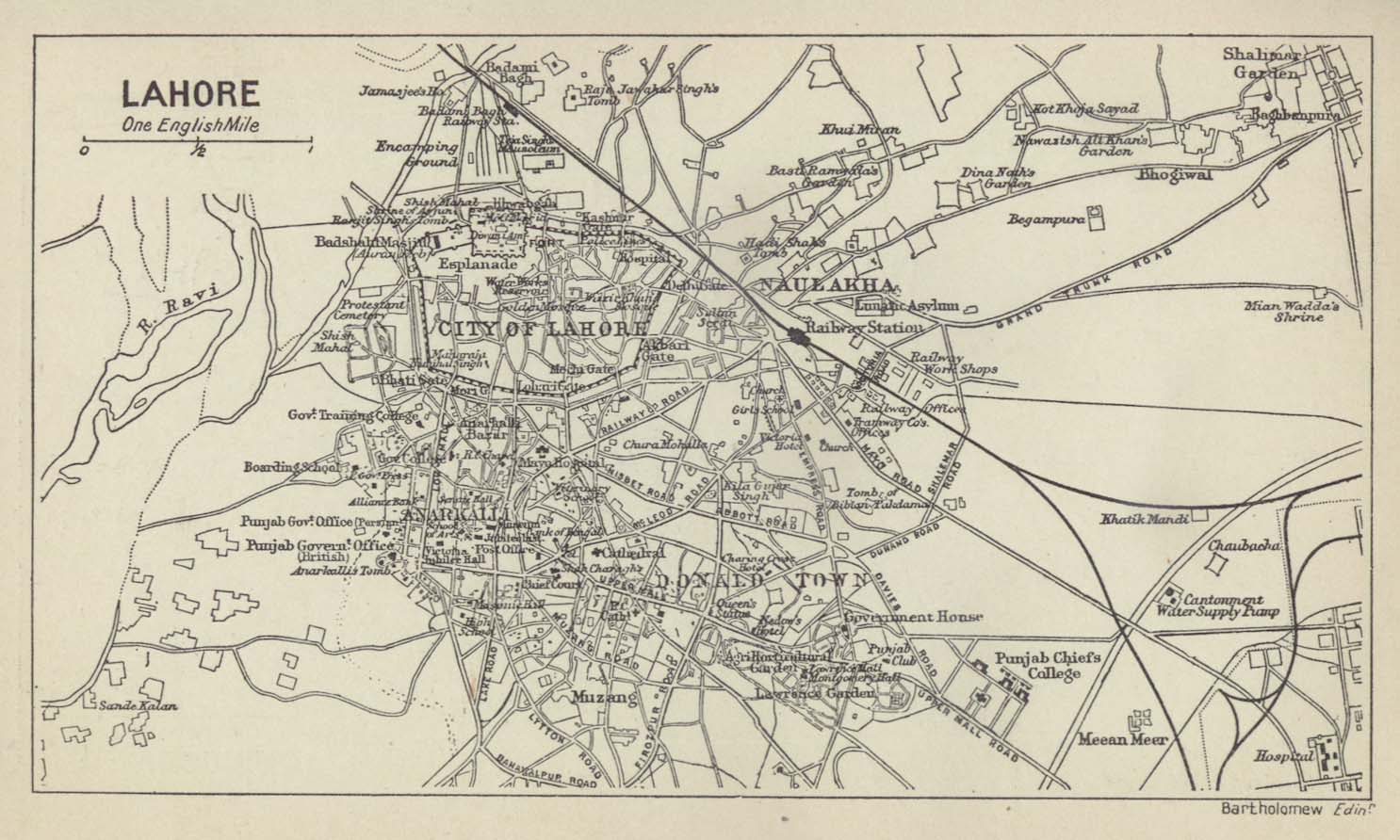
Lahore (City Plan) From A Literary and Historical Atlas
of Asia by J.G. Bartholomew. J.M. Dent and Sons, Ltd. 1912
(188K)
-
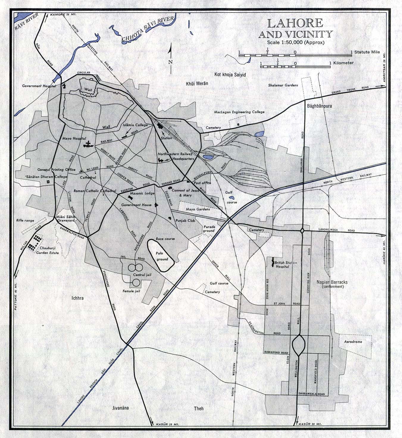
Lahore and Vicinity (City Plan) original scale 1:50,000.
From Sheet NH 43-2, Series U502, U.S. Army Map Service, 1963
(333K)
-
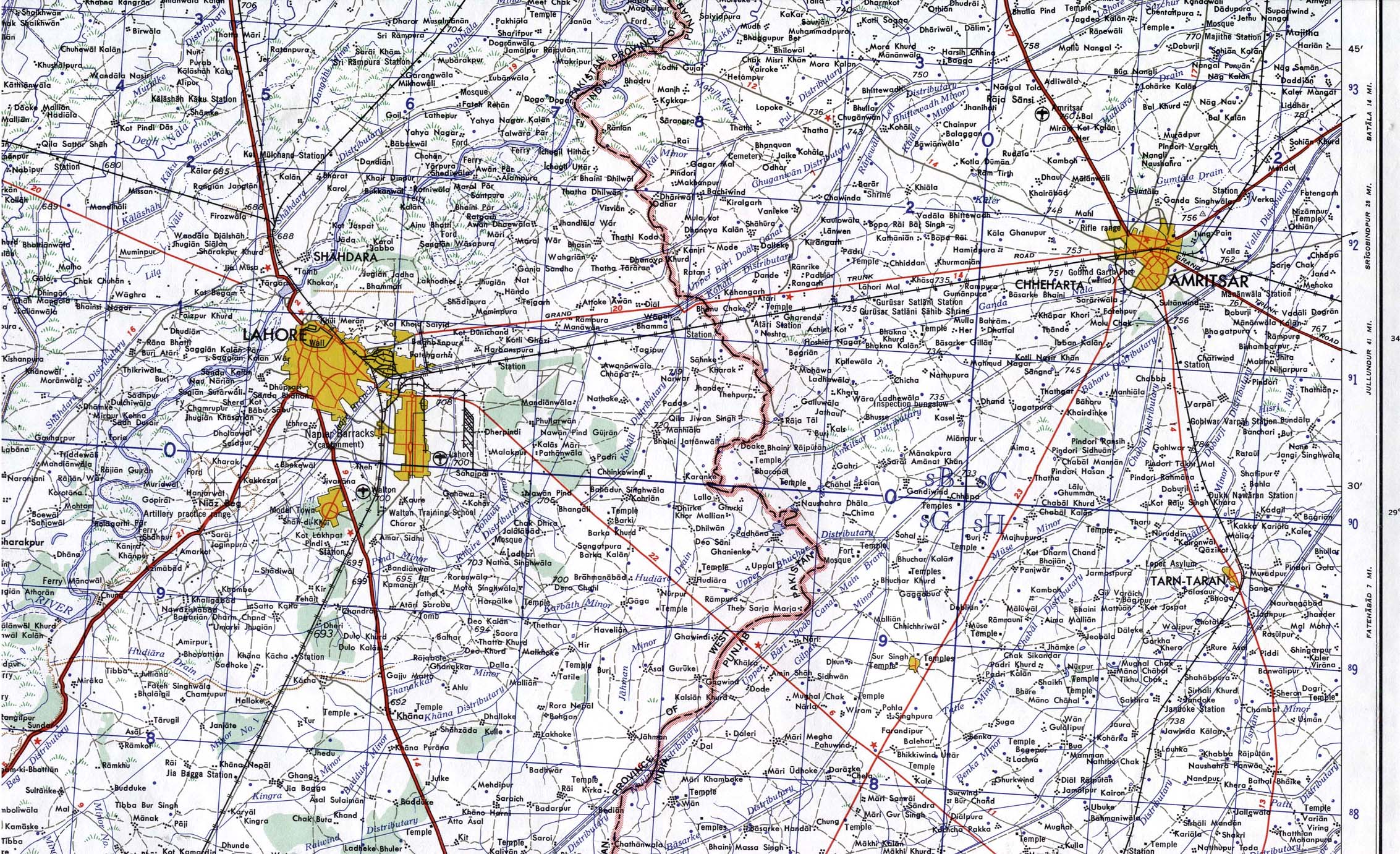
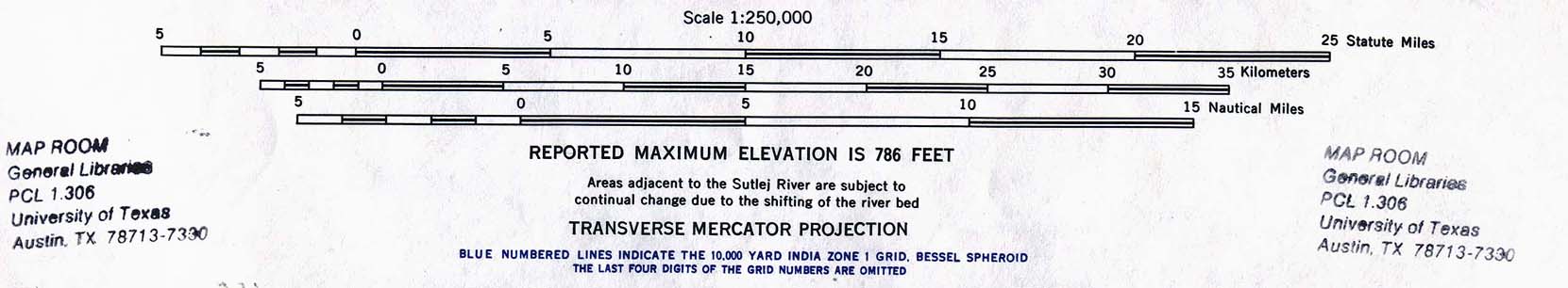
Lahore (including Amritsar, India) (Topographic Map)
original
scale 1:250,000. Portion of Sheet NH43-2, Series U502,
U.S. Army Map Service, 1963 (947 K)
-
Multan (City Plan) original scale 1:20,000. Portion of
Sheet NH 42-8, Series U502, U.S. Army Map Service, 1959
(378K)
-
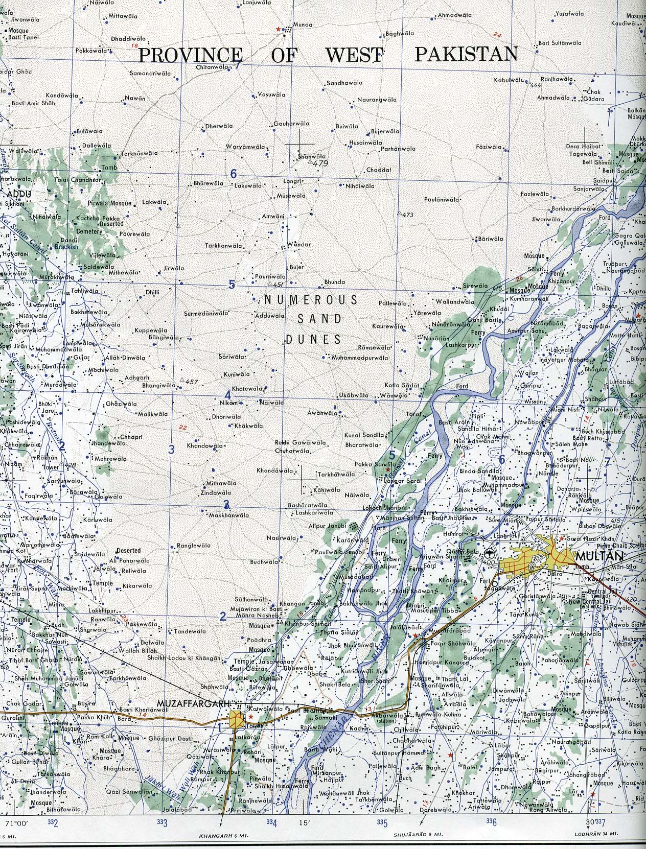
Multan (Topographic Map) original
scale 1:250,000. Portion of Sheet NH 42-8, Series U502,
U.S. Army Map Service, 1959 (741 K)
-
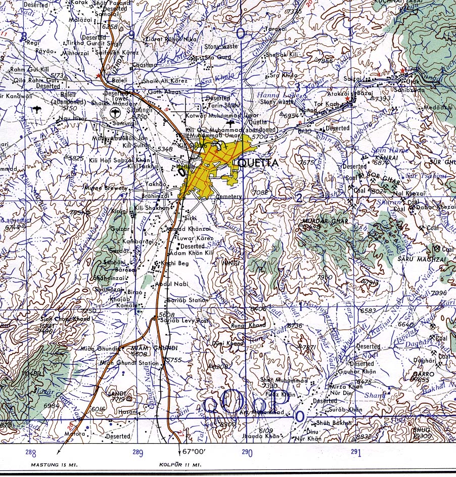
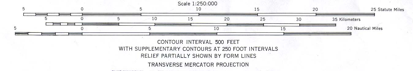
Quetta (Topographic Map) original
scale 1:250,000. From Sheet NH 42-5, Series U502, U.S.
Army Map Service, 1959 (445K)
-
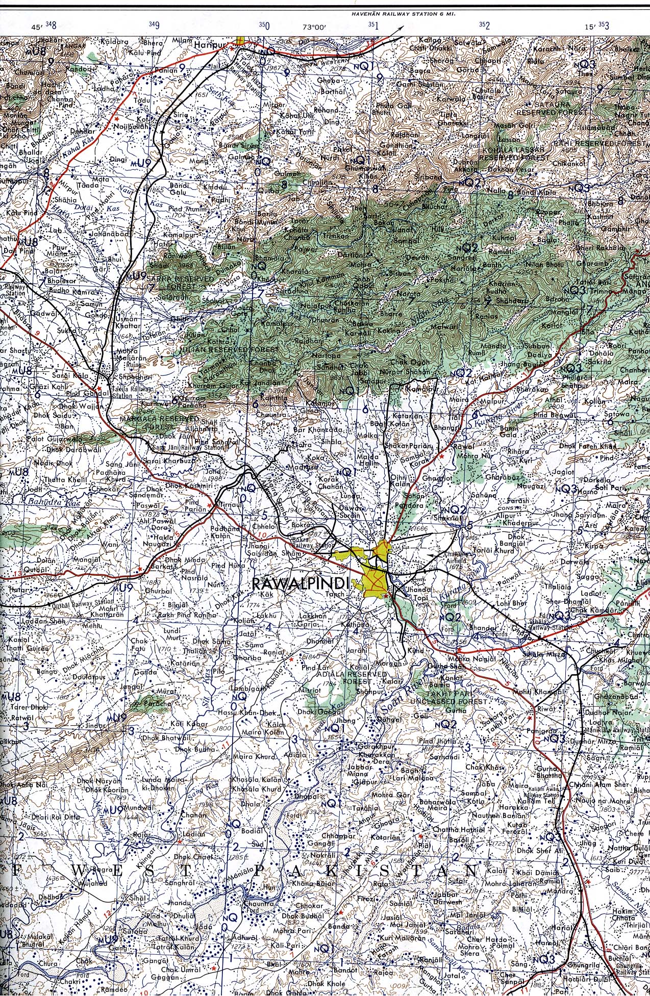
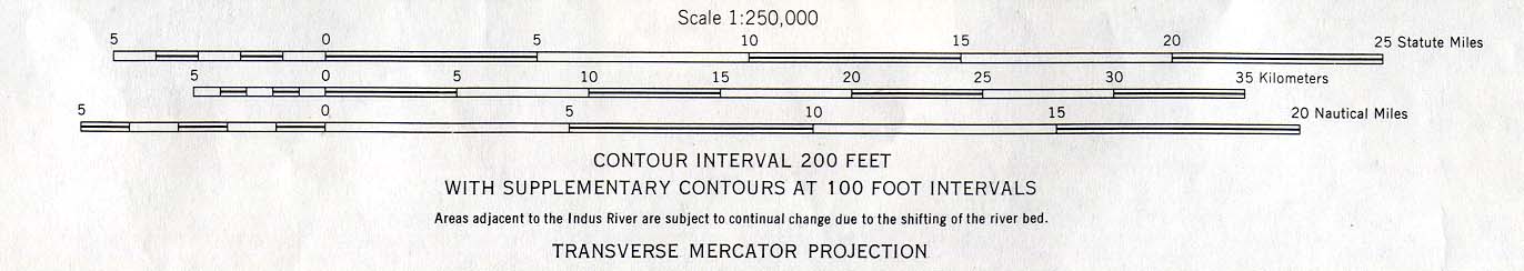
Rawalpindi (Topographic Map) original
scale 1:250,000. Portion of Sheet NI 43-9 , Series U502,
U.S. Army Map Service, 1959 (1.2MB)
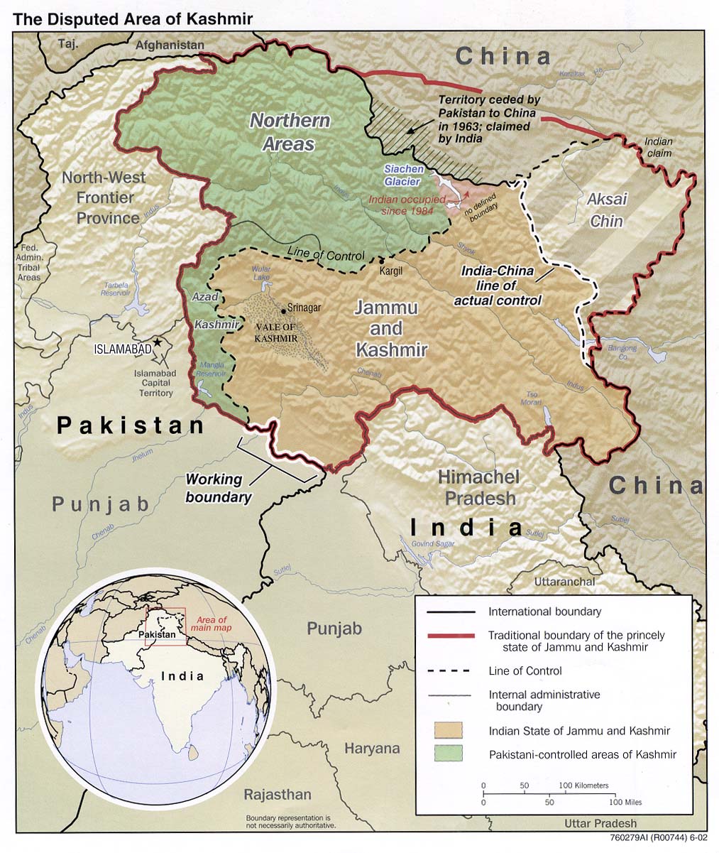
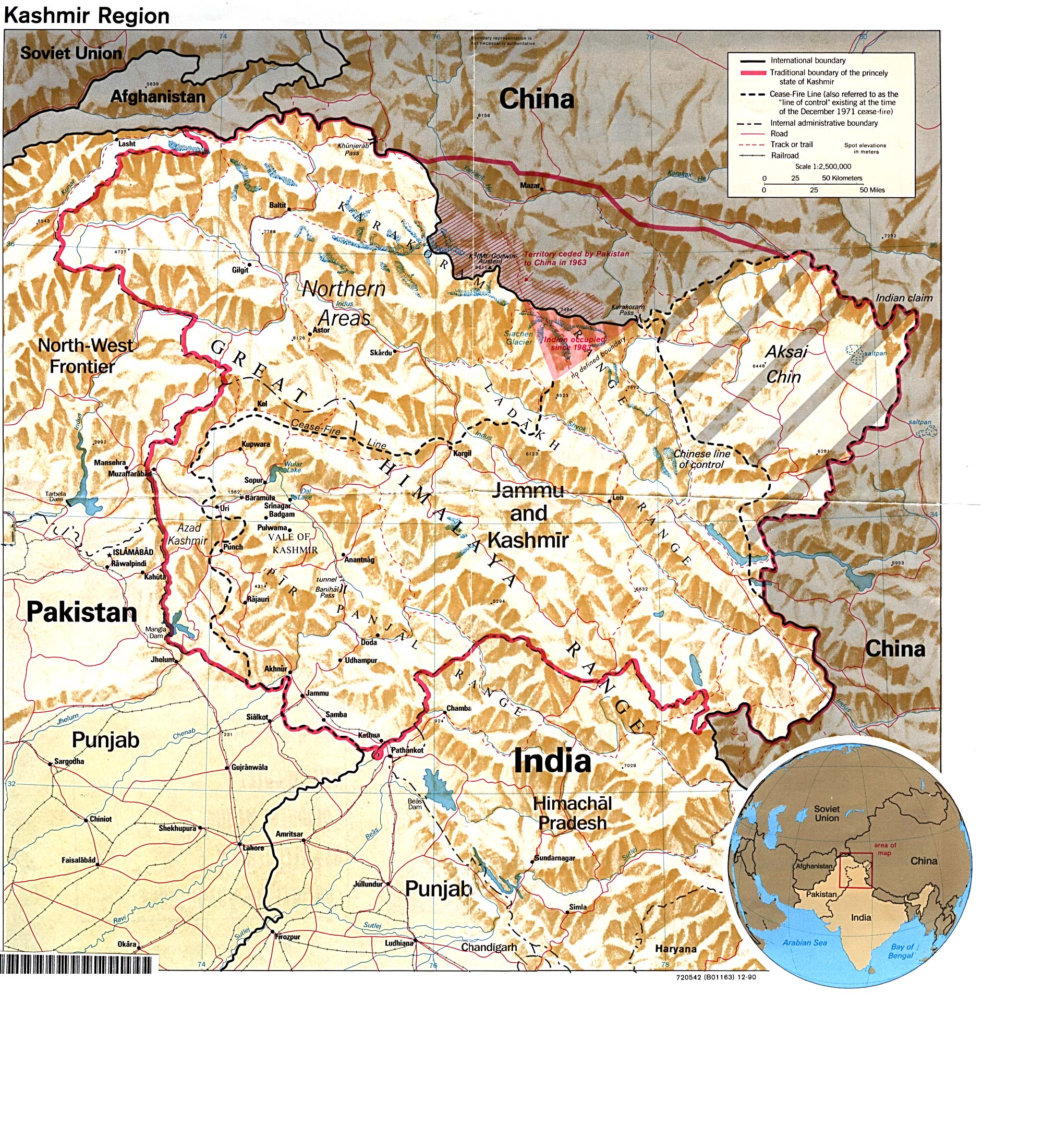
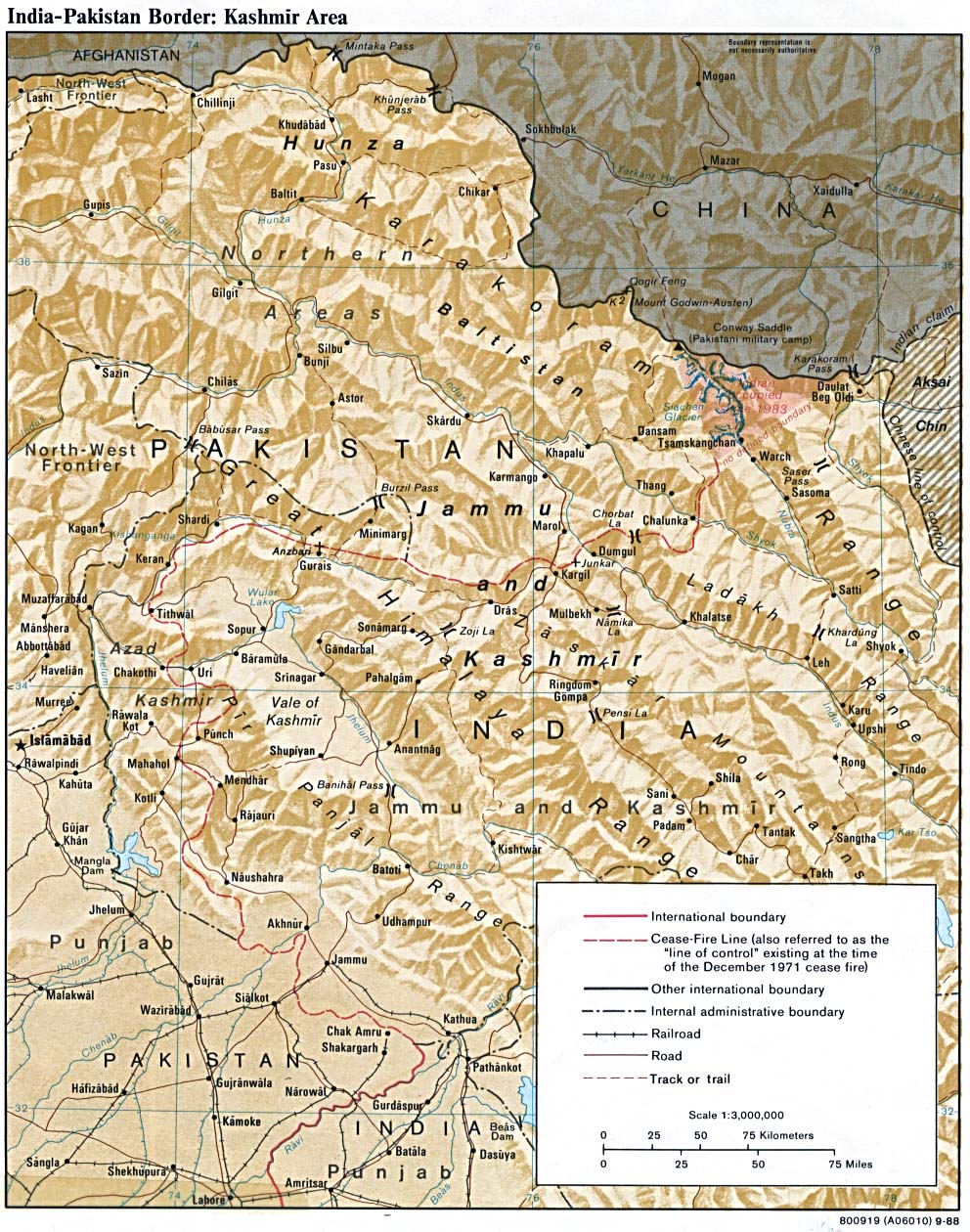
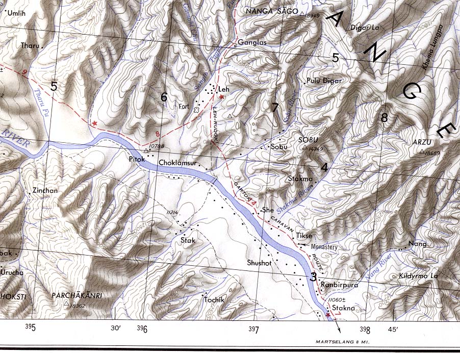
Kashmir
Maps
Maps of India and Pakistan
Detailed Maps
-
Muzaffarabad Border Region Original scale 1:500,000
Portion of Defense Mapping Agency TPC G-6C 1992 (1.2MB)
Not for navigational use
-
Srinagar Border Region Original scale 1:500,000
Portion of Defense Mapping Agency TPC G-7D 1995 (1.1MB)
Not for navigational use
-
Srinagar to Kargil Original scale 1:500,000 Portion
of Defense Mapping Agency TPC G-7D 1995 (1.1MB) Not
for navigational use
Historical Maps
|


![[Kashmir and Northern Areas] Eastern Section (satellite image map)](http://www.lib.utexas.edu/maps/middle_east_and_asia/kashmir_east_1997.jpg)
![[Kashmir and Northern Areas] Western Section (satellite image map)](http://www.lib.utexas.edu/maps/middle_east_and_asia/kashmir_west_1997.jpg)